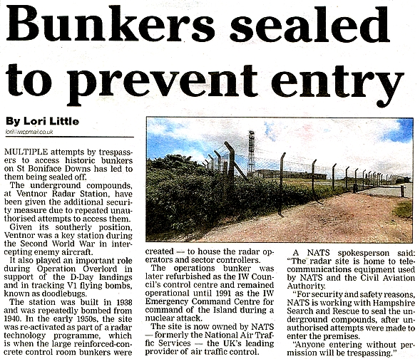
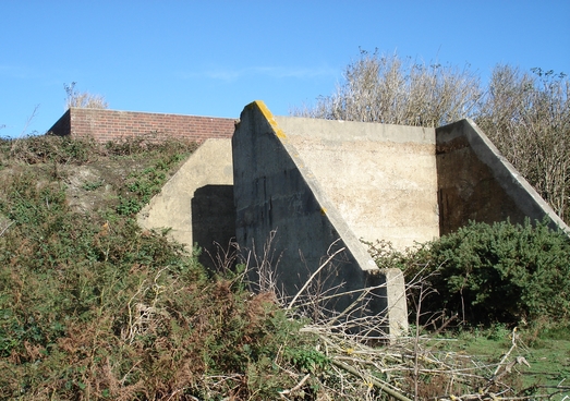
First, just to show the elevated terrain here is an old wartime 'plinth' building which may have supported a now unidentifible type of radar. Or it might be the anti-aircraft machine gun post that was somewhere in the area. The building is situated outside the wired-in compound and the photo serves to show the location of one of the distant VHF towers on Stenbury Down and the surrounding typical Isle of Wight countryside.
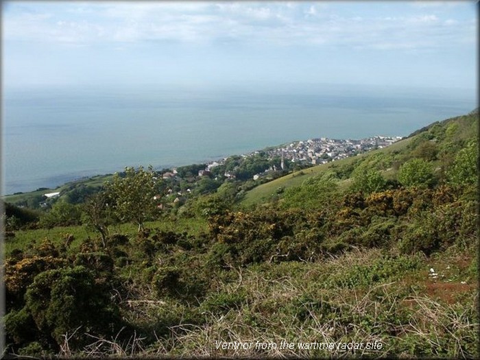
Facing the above view, just across the narrow road there are the Civil Aviation Authority premises within the old compound. I feel that a picture of such ought not to be displayed but there is only one rather featureless single storied building so you are missing very little as there have been no rotating radars present on the site for many years.
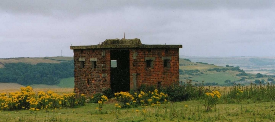
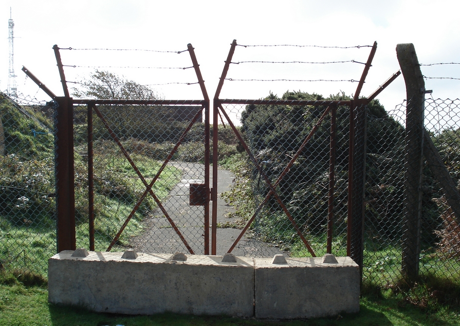
Just inside the tall double gates, immediately on the left stood the nineteen fifty built 'bungalow' guardroom, to the rear of which was the spiral staircase down to 'The Hole'. The bungalow was demolished in 1991 and this thick concrete slab now covers the underground access. But since this photo was taken the slab and the bungalow foundation have been covered with chalky earth and there is no evidence at all that an underground R1 bunker ever existed. The ventilation / emergency egress tower has been removed and presumably similarly sealed and interred.
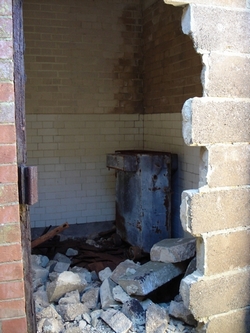
Even the Type 80 Modulator Room shown below has been demolished in recent years. The author spent many tedious long evenings or nights entombed in here. The larger left hand section of this building is the part which was straddled by the legs supporting the platform for the rotating aerial as shown in pictures in the Type 80 description. The section with the louvred shutter housed the motor / alternator set.

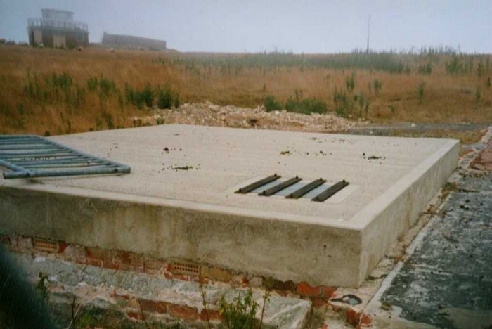
The wartime T Block and its associated steel transmitter masts stood near to the building in the above photograph but R Block with its wooden towers was situated a couple of hundred yards away at the south western end of the St.Boniface site. Below you can see the massive concrete block footings for one of these and the shell of R Block is close by.
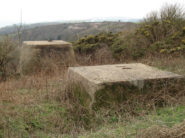
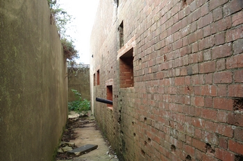
R Block is surrounded by massive anti-blast earthen banks and the entrances protected by concrete walls.
A few weeks afterwards the reason for the partitioning off of the used compound became clear. The old CH part of the site was sold by auction on the 11th.October by The Allsop Company for £61000 on behalf of site owners BT to persons as yet to be revealed. Details were available from www.allsop.co.uk
A clarification regarding the ownershop of the CAA site is appropriate here. It is known that 221.34 acres of St.Boniface was donated by a Mr.Llewelyn Evans to the NT in August 1922 and this is now shown on the current NT Land Map. The donation was made on behalf of the late Mrs. Caroline Ann Evans of Roehampton, presumably his deceased mother. The Times newspaper of 18th. August carried a letter from the National Trust's most senior officers to announce this to the general public and that it was their first acquisition of land on the Isle of Wight. A rather crude but accurate map of the donated area was also published. The donor's wish was was that nothing should be done to interfere with the area's natural beauty. However, it is the land immediately to the north of this that is the parcel still used by the Civil Aviation Authority. Subsequent gifts of land to the National Trust caused the CAA site to be completely surrounded by Trust land. This explains my previous long held mistaken belief that the land must have been obtained by the Air Ministry from the Trust in about 1933. I have recently made enquires about this matter to the NT Land Map department and received a reply which confirms how the CAA site came to be an island within their land.The Isle of Wight County Press reported on the 14th.October 2005 that the auctioneer stated that the amount of interest had been surprising in view of the planning restrictions on the site. He expected that the new owner would maintain the site and wait for a change in planning policy. The site is outside the development envelope and is adjacent to a designated site of special scientific interest. In addition it is within an area of outstanding natural beauty and a designated site of importance for nature conservancy. The IW Council Planning team leader had told enquirers prior to the auction that it was highly unlikely the plot could be used for a residential development. A local environmental campaigner Dr. Paul Hatchwell called on the IW Council to make further designations to ensure the site's historical importance was maintained.
News 03.10.06 On visiting the R Block with Harold Lewis who was familiar with the building from his RAF days, it was found to have been fitted with a new double bolted and padlocked plywood door. However vandalism was evident in that an original external side door which had at sometime in the past been sealed with building blocks, now has a gaping hole in it. This gives access to a small tiled room in a rear corner of the block. Could it have been a battery room for emergency lighting? 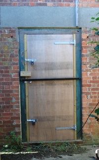
News at 08.10.08 This is the current state of conversion for whatever purpose:-

However the slow progress of the conversion is mystifying, especially as no progress was made at all neither during the winter of 2007/2008 nor during the summer of 2008, so this prompts ever increasing conjecture about planning objections and / or the financial resources of the new owner. The latest vandal attack has resulted in the plywood door (shown above) and its frame being ripped out and the VEB room has had the hasp prized off again.
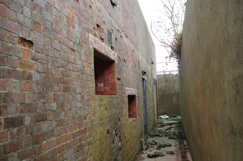
The sad story continues: on inspecting R Block on the 2nd. of March 2009, the interior walls were found to be covered with graffitti which I certainly do not intend to display here.
On 29.09.09 a slight improvement was to be seen. Most of the graffiti has been removed or covered with whitewash and the rubbish filled cable pits covered with hardboard. Has the place been
visited by an alternative band of intruders wishing to use it for an alternative purpose (dossing) or has the owner woken up at last? Also the wooden door has been replaced into position and the
thrown down coping stones have been removed from the exterior walkway. It is now obvious which room was the toilet and Harold has identified the Calculator room. A subsequent
inspection in October 2010 by the pair of us showed that this state is now the status quo. A contact reports that "raves" are held there. A subsequent visit in April 2011 was somewhat
thwarted by a 'Police Aware Keep Out' notice fixed to the chain link fence. It seemed that the ravers may have over-raved to their own disadvantage.
On a visit in October 2011 we found the police warning notices had been removed. The interior graffitti seemed somewhat increased and broken glass crunched underfoot.
However there is some very good news! It transpires that R Block received Grade II listing in September 2013. Perhaps somebody who could get such things done had read this page? There is a planning application to turn the historic R Block into a four bedroomed holiday home accommodating up to
ten people. In the application this proposal is cynically described as the best way of 'preserving' the building. Hmmm. The building deserved listed status years ago, especially after Bawdsey's T
Block came to public attention in the TV Restoration series, and became third in the viewers' estimation of restoration worthiness. Surely an R Block needed to be restored to its original state too,
for the nation and for posterity? However the cutting of the window apertures in 2006/7 which many would consider an act of vandalism, put paid to that faint hope at Ventnor. Bedrooms are
planned to replace the Operations room, the Power Distribution room, and The Calculator Room which housed an electro-mechanical very early form of analogue computer.
Anyway, go to the application and form your own opinion. Choose 'All Applications' then "town" and finally "Wroxall" from the drop down. After studying the plans at length, Harold Lewis and I have very reluctantly reached the conclusion that the planned conversion is after all probably an acceptable outcome as at least the building will cease to decay further. The same gaunt outline seen in the photograph to the left will more or less remain as will the banked blast walls. The building will be only three quarters of a metre higher than it is at present although a raised rooflight will protrude above that. The Area of Outstanding National Beauty people object to this and to the expected light pollution. It seems that they were involved in 'pre-application' talks a year ago. The surrounding gorse and brambles will remain and the chain linked fencing repaired. The tall slim BT mast will be removed and there will be parking for only three cars. In May 2014 a Planning reapplication was made showing shutters to overcome the the light pollution problem. I have been contacted by the architect applicant who informs me that the owner is fully aware of the key importance of RAF Ventnor in those fraught early war years and that the intention is to create an 'information board'. Whether this is to be for the benefit of the passing general public or merely for the occupants of the holiday home was not stated.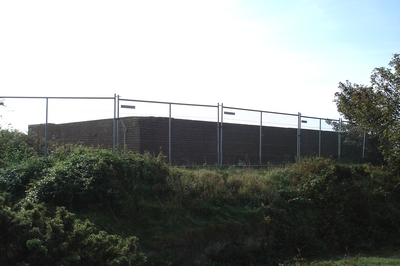
 However by October 2013 the
building had been surrounded with mesh barrier panels and a builders' warning notice had appeared fixed to the gate, although no new building work was in evidence. Somebody had
disconnected some of the mesh panels (the ravers?) and a brief inspection of the interior through one of the new window apertures showed that the previously covered over cable pit
has been reopened and partly filled with what looks like broken insulation panel material.
However by October 2013 the
building had been surrounded with mesh barrier panels and a builders' warning notice had appeared fixed to the gate, although no new building work was in evidence. Somebody had
disconnected some of the mesh panels (the ravers?) and a brief inspection of the interior through one of the new window apertures showed that the previously covered over cable pit
has been reopened and partly filled with what looks like broken insulation panel material.
27.11.14
However our bi-annual inspection of the site on 04.05.16 found that no work at all had yet taken place, and there was evidence that some unauthorised activity continued to be made within the building. The builder's security panels shown surrounding the building in the photograph above left, had all disappeared. In addition the previously unlocked gates had a padlock but a considerable amount of fly tipping was in evidence. In the VEB room a large mural depicting "chaos" had appeared and in the doorway were the piled ashes of a bonfire. As we were leaving the site we were hailed by a male person standing on the gravel heap. It seemed that we had disturbed a dosser. One wonders how long this state of neglect will exist. "Preserving the building" ? Fine words indeed, but only words. It is urgent action that is required.
By September 2016 there had been still no start to the conversion. However the large breaches in the perimeter wire mesh fencing had been repaired, the fly tipped material removed and the entrance gate blocked with heavy concrete pieces. Strangely, the mesh on the gate still had a hole sufficiently large to allow human access. The planning permission will expire by 27.11.17 unless the work has been started by then. Does the little done so far count as "work"?
30.10.17 The situation remains the same but the hole in the gate has been repaired and it is fitted with two strong padlocks. There is no sign of any other activity.
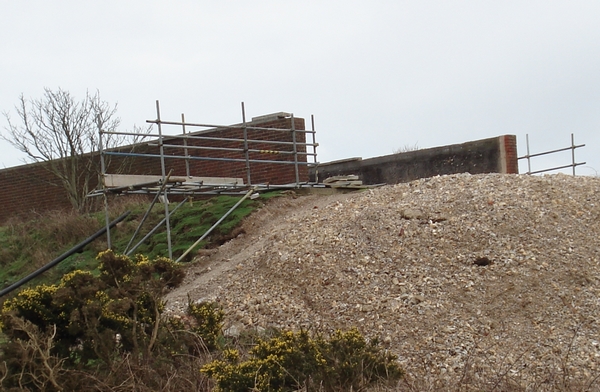
10.05.18 Harold Lewis has reported that the work is at last started.
26.06.18 Part of the structure is being extended upwards.
October 2019 This long drawn out saga has at last reached its climax
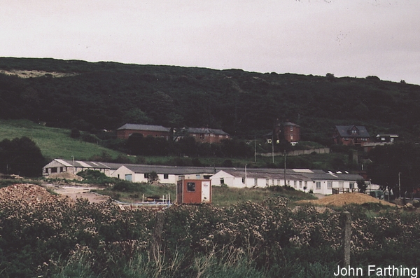
There is nothing left of the Lowertherville domestic site now and this picture shows it in the process of being demolished......
because at this date the conversion was available for purchase at an asking price of the best part of a million pounds!
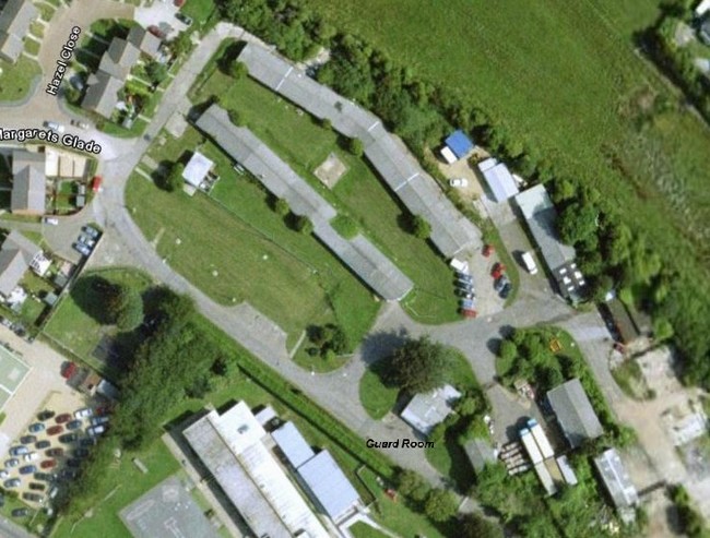
...... and below Google Earth shows us what the Lowtherville Road domestic site looked like in 2015. The Transatlantic Plastics company used some of the buildings in the seventies and eighties and while half of the site has now been now taken over for housing, the few remaining huts have been conjoined to facilitate their light industrial use.
You might like to compare this with the former layout, using the Guard Room as a common reference point.
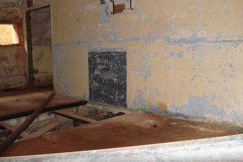
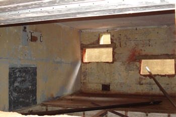
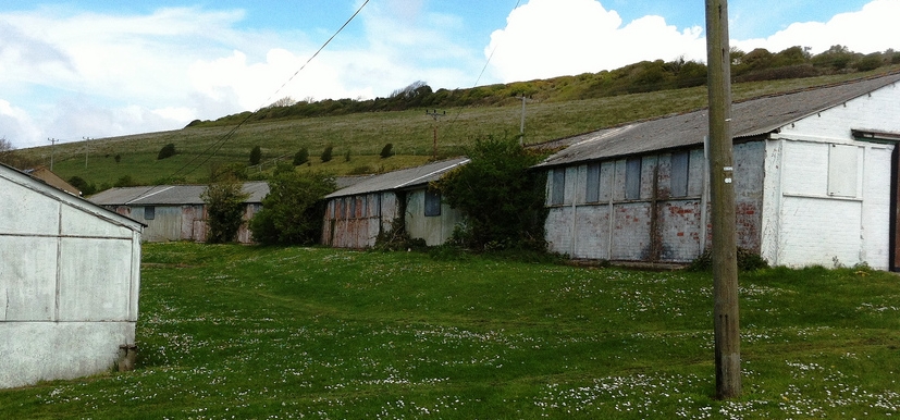
A Derelict Places contributor has taken some very good pictures of what remains of the radar site and added some hi-jacked ones from here too, without any acknowledgement, needless to say. Had he read properly what I have written here his commentary might not have contained the errors it does! As he has 'borrowed' some of my pictures I feel quite justified using this one of his of some of the Domestic site huts. Beneath the peeling white paint the red bricks are reappearing.
As regards the Down Lane Married Quarters : after the Radar site closed down in 1961, as the houses became available they were occupied by wives and families of RAF personnel serving abroad. At some as yet unascertained date it is believed the the houses became owned by the local council. Old folks' bungalows were then built in the central open space and the road became "Downside". It is believed that now all the original houses are in private ownership. When the Squadron Leader's house was sold it was advertised as the ex Wing Commander's house! The Sergeants House was (Oct.2013) on the market.
Text © 2006 D.C.Adams
Photograph© 2006 John Farthing
Rev 26.06.20